Wednesday, March 31, 2010

Stromeferry - Part 7

Part 1 here.

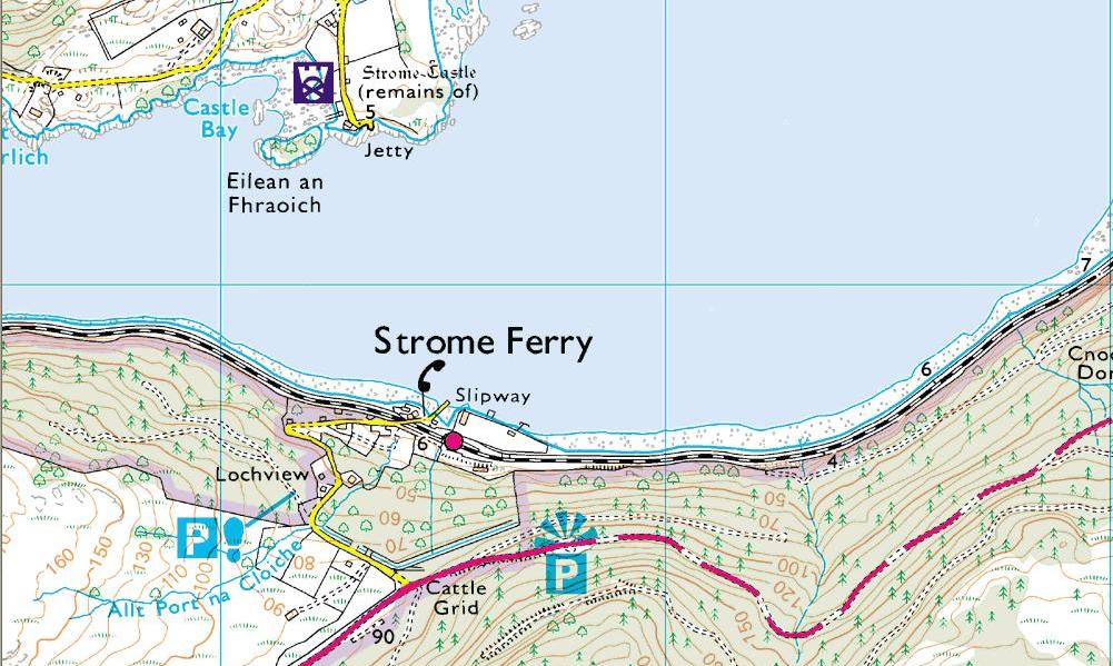
Picking up the story from Part 5, in the years after the First World War (1914-18) when motoring began to take off, the car ferry across Loch Carron developed firstly by becoming itself motor powered and secondly by the addition of a method of embarking vehicles more convenient than a pair of long planks of wood.


This was the turntable which, once the vehicle was aboard, could be swung round and stowed lengthwise along the boat's main axis while on passage. As well as avoiding the payload sitting awkwardly athwart-ships as on the "plank-loading" ferries, the main advantage was that, as the turntable could be swung though 360 degrees, the car could drive off "ahead" even when, as was the case at the Strome Ferry, the slipways at both sides only allowed the boat to berth port (left) side to: without the turntable, the car had to reverse off or else the boat had to reverse in at the other side. Turntable ferries became the norm at most short vehicular ferries on the west coast of Scotland in the 1920s.

Now I don't know the exact history of the sequence of the various vessels on the Strome Ferry over the years (if anyone does, please leave a comment) but the next development - in the late 1930s I'd guess - from a single vehicle turntable ferry as pictured above was a two vehicle ferry as seen below at the north terminus in a mid 1950s view:-


Note how the crew appear to be dressed in shorts and stockings and peaked caps. I bet they only dressed like this for the J Arthur Dixon photographer and it was boiler suits and bunnets every other day of the year!

Picture credit Rob Beale

Perhaps the stockings and peaked caps were to mollify angry MPs. Sir William Anstruther-Gray, member for Lanarkshire North, mentioned in the House of Commons in 1937 being stranded on the ferry with his car for three hours. It seemed that, having got the car on board, the state of the tide was such that it could not be disembarked again at either side for three hours. It's unclear from the parliamentary report whether the difficulty was due to the tide being too high or too low but either could pose a problem - at a very low tide, the water is too shallow for the ferry to get alongside but at a very high tide, the slipway simply disappears under the water. Whichever, the issue was dealt with by the slipways at both sides being raised and extended in concrete in the late 1950s (note that in the pictures above, the slipways are still the original stone before this improvement).

The final generation of car ferry at Strome arrived in 1959, this being the Strome Castle, a six car turntable ferry built by Forbes' of Sandhaven, just east of Fraserburgh pictured below at Stromeferry:-


But improved piers and a bigger ferry were not enough to prevent continued questions in the House. In June 1960, the Independent MP for Ross & Cromarty, John MacLeod, in whose constituency the ferry lay, rose to ask the Secretary of State for Scotland if he was aware that there had recently been an instance of people having to wait three hours for the ferry in a queue of 42 cars and when the Government proposed to build a road round the south side of Loch Carron? The minister was typically non-committal and replied by pointing out that such delays were exceptional and highlighting the recent improvement in the ferry service with the deployment of the six car Strome Castle.


In 1962, another six car turntable ferry, the Pride of Strome, built by Nobles of Fraserburgh, was introduced:-

 
But by now the question was no longer "if" but "when" a by-pass road would be built and the Government eventually approved the funding in October 1965. But it was not for another five years, in October 1970, that the road round the south shore of Loch Carron was finally opened and the ferry closed.


This time, however, the village not only ceased to be a terminus as had happened when the railway was continued to Kyle of Lochalsh in 1897 but it was totally by-passed and left as a dead end as the new road passed by up the hill-side and giving rise to that famous "Strome Ferry - No Ferry" sign.


My own memories of the ferry are that, in the late 60s, we used to go on family holidays to Kishorn just north of Loch Carron and the journey always involved crossing the Strome Ferry (unless we were travelling on a Sunday when the ferry didn't operate so we went round via Inverness instead: in the days before the new A9, that involved a considerable extra distance.)
 
 
Although I was only 6 or 7 at the time, I remember the ferry well. I distinctly recall the sound of its diesel engine as it swept up to the slipway and the helmsman abruptly put it into full astern to bring it to a halt, expertly kissing the pier, the water white with foam - water being churned by a ship's propellor was a source of great fascination to me at that age. Another crewman was poised to step ashore with a rope with a metal hook on the end which was inserted in a hole on a metal strap down the centre of the slipway. The mooring rope was either run out from the stern of the ferry and the hook put in a hole forward and the engine left running astern to keep the boat against the pier  while loading (as in the picture below of the 1959 Strome Castle) or vice versa (rope from bow and engine left running ahead).

 
I'm guessing it depended on the state of the tide and how much of the slip there was above water to berth alongside but either option produced lots of churning water for my youthful delectation.

Then after the cars were all aboard (bearing in mind that, at low season, that could be a wait of 20 minutes or so waiting for four or five cars to appear if not necessarily the full compliment of six), the engine was momentarily relaxed to give a bit of slack to release the hook. Then a big burst astern to pull the ferry away from the pier and cut back to neutral as it was turned round to face the other side. Then full ahead again for a passage of just three or four minutes before the engine was cut for a moment and full astern for the whole process to begin again at the opposite terminus.

Picture credit Anne Burgess

I remember one occasion arriving late at the south terminus at Stromeferry and the last ferry had gone for the night. But my father could see movement on the pier at the other side so flashed the headlights of the car in an attempt to encourage the ferry to come back over to collect us. But no joy and we slept in the car till the next morning - a great treat when you're aged 7 but a bit of a chore otherwise. But in 1969 you just put up with these things ...

Sunday, March 21, 2010

Pabail


I read somewhere recently that Google Earth is of great assistance to archaeologists researching sites in parts of Afghanistan which are off-limits due to the sway of the Taliban. Well the same is equally true of the Eye Peninsula on the east coast of the island of Lewis in the Outer Hebrides (off limits - on a Sunday, anyway - due to the sway of the Free Church of Scotland!).

Note how on the following extract from GE in the village of Pabail, on the south east coast of the Eye Peninsula, you can see the footprints of various buildings I've labelled A, B, C, D & E


And note how you can see the same buildings on the 1849 Ordnance Survey 6 inch (1:10,560) map:-


A village cleared during the Highland Clearances? I don't think so because, if you pull back the scale a bit, you can see the village of Pabail still existing close by: it's unlikely the occupants of these ruins would have been "cleared" to a location so close by:-


One theory - and this is just pure amateur educated guesswork - is that these ruins are the remains of parts of the old run-rig village of Pabail before it was re-arranged into lots (crofts) on the pattern shown on the 1849 map during the kelp boom of the early 19th century.

I accept, incidentally, that the distinction between "re-arrangement" and "clearance" of a village is a fine one except to note that a number of "re-arranged" villages were later "cleared" in the decades after the end of the kelp boom at the end of the Napoleonic Wars (1815).

Pabail, however, survives to the present day in roughly the same pattern as in the 1840s as can be seen from the present day OS 1:25,000 map (courtesy of Streetmap.co.uk, the best place to view the OS 25k map) and GE which both show the crofting layout well:-


And this is what it looks like courtesy of Google Street View:-


And in the picture below, the ruins are half way to the houses on the skyline (which is the "suburb" of Pabail called Eagleton which didn't exist in 1849):-


And finally a word about the Gaelic rendering of the name of the village. It has two parts and on my unreconstructed 1960 OS one inch map, they are labelled Upper and Lower Bayble. As you can see on the 1849 OS map, these are rendered respectively Pabaill Ard and Pabaill Iosal but on the modern 1:25k map they've become Pabail Uarach and Pabaill Iarach. Now I'm no Gaelic scholar but I'm aware that ard and uarach both mean something like "high" or "upper" whereas iosal and iarach both mean something like "low" or "lower". But why the change over 150 years?

I can't help suspecting the OS went to their in-house Gaelic speaker and asked "What's the Gaelic for "upper"?" and he/she answered uarach. And thus the subtle nuance which led to the upper part of Pabail being named Pabail Ard (as recorded in 1849) rather than Uarach is at risk of being lost to history. Ditto Pabal Iosal/Iarach.

I gather that whether you spell it Pabail, Pabaill or Bayble is pretty academic because it's not a Gaelic name anyway but a Norwegian one meaning "Priest's Village". Of equal interest (to me) is how a place in this Norse-Celtic milieu came to be given the very English name of Eagleton. There must be a story behind that to be discovered - although I note that someone at the Comhairle with more sense of political correctness than history has transliterated it into Baile na h'Iolaire. Tsk!


Sunday, March 14, 2010

Google Street View

As usual, I'm probably the last to hear about this but if you haven't yet, Google Street View has been rolled out to the West Highlands and Islands.

If you thought Bing aerial photography was good, then Street View really is the dog's knob. But be warned it's very Not Safe For Work because you can waste seriously large amounts of time browsing on it.

For anyone not aware of this, go to Google Maps. Type in the name of your place of interest (or navigate to it on the map) and zoom in a bit until you can see roads. Note the little orange man at the top of the scale bar to the left of the map. Click and drag him to where you want to go. If there is Street View coverage (and I haven't found anywhere in Scotland yet that doesn't have it along a public road, be it ever so remote), the roads with coverage will be highlighted blue and then in a few seconds, you'll be looking at a view along the road where you dropped the orange man.

My tip for navigating along a road is to use the mouse to drop the white disc as far away as it will go - about to the next passing place, usually - and double click and you'll be taken to that point. (Don't double click if the disc turns into a square though - you'll see what I mean when you try it.) You can navigate ahead (or back) with the up and down arrows on the keyboard (not the ones in the number pad) but that takes you at a rather slow pace. Using the mouse click method described above takes you at about walking speed. Use the right left arrow keys to rotate the view clock- or anti-clockwise.

So, as it was the Isle of Jura blog which drew this to my attention, I took myself off to Craighouse first, a place I haven't been for 15 years.


I was struck by the similarity between this and the same view almost 200 years earlier as recorded by the water colourist William Daniell who circumnavigated Britain in 1814.
 

That's exactly the same building, pier and bridge. And although Daniell has exaggerated vertically a bit, that's the north-most of the Paps of Jura, Beinn Shiantaidh, visible in both views. 

Today, I spent a lot of time "virtually" on Raasay where I encountered this remarkably suburban scene:-


The reason is that Raasay is home to, of all things, a mining village. Outside toilets and coalsheds in sight of the Cuillins - who'd have thought. This is a subject I will return to in a future post.

One thing that does strike me having "virtually" wandered round quite a lot of Raasay this afternoon is that the Highland Council bright blue wheelie-bins are incredibly ugly. Would a different colour - like khaki or dark brown - not blend into the landscape a bit more? Not so much here amongst the white cottages of Inverarish but they're a real blot on the landscape at the road ends of Balachuirn and Balmeanach. It seems a bit rich of Highland Council to restrict planning permission to "aesthetically sensitive" buildings when they roll out blue wheelie bins. Philistines!

Another good tip for browsing on Street View is to have the Ordnance Survey current 1:25,000 scale map open in another window courtesy of Streetmap. And the 19th century OS 6 inch map (1:10,560) available via National Libraries of Scotland open in a third window. And, of course, Bing aerial photography and/or Google Earth on the go too (GE in the case of the south end of Raasay).


The fact that all this material is available free, I find just incredible. It's great for someone like me who loves Scotland but doesn't live there to be able to explore it in this way. I wonder where I'll go tomorrow - Rodel? Salen? Arinagour? Lochboisdale? Laxford Bridge? All of them - I'm like a kid in a sweetie shop!

Thursday, March 11, 2010

Loch Etive

 
A nice postcard posted in June 1958 from Ledaig - better known as Benderloch nowadays - just north of Oban in Argyll.

The view is of Achnacloich Pier on the south shore of Loch Etive about 3 miles east of Connel and about 8 miles from Oban. There used to be a halt here on the railway to Oban (between Taynuilt and Connel) but it was closed in the 1960s.


The boat at the pier is the Darthula II. She was built by Dickies' of Tarbert (Loch Fyne) in 1939 and sailed from Achnacloich to the head of Loch Etive as part of a circular tour returning by motor coach via Glen Etive and Glen Coe and then the train from Ballachulish to Connel and Oban. The tour was advertised in Brtish Railways' 1957 "Circular Tours in Scotland" brochure with the Darthula II being described as a yacht and she certainly looks it in this closer up picture:-

 
Picture credit Simplon Postcards

In 1957, the round trip from Oban was every day (except Sunday, of course) from June to September and cost 19 shillings and threepence (96p) 1st Class or 16 shillings (80p) 2nd Class. You could go either way round but the "anti-clockwise" route involved boarding the train at Oban at 9.18am and alighting at Achnacloich at 9.44am. The Darthula II sailed at 10.15 and, via a call at Taynuilt, took two and a quarter hours to get to the head of Loch Etive arriving there at 12.30pm. 50 minutes later (what did you do at Lochetivehead for 50 minutes if it was pouring?), the coach left for a 2 hour 10 minute drive up Glen Etive and down Glen Coe to Ballachulish. Arriving there at 3.30, it was only 20 minutes till departure of the train back to Oban where it arrived at 5.35pm.


The Darthula II continued on Loch Etive until 1963 after which she gave cruises on the Thames for a number of years. I was quite surprised to discover that she was still sailing in Portsmouth Harbour until the last few years, a little bit altered (and slightly less "yacht-like"), although I can't find her present status - if anyone knows, do leave a comment.

Picture credit Simplon Postcards

Meanwhile, back on Loch Etive, Achnacloich Station has closed as already mentioned and I don't think the pier there exists anymore either. The railway between Connel and Ballachulish also closed in 1966 and the pier at the head of Loch Etive is rotting away from disuse.

       
Copyright Nigel Brown and licensed for reuse under this Creative Commons Licence

So there's no longer a circular tour but it is still possible go on a non-landing cruise up Loch Etive from Taynuilt in summer. Until recently, this was on a vessel called Anne of Etive which looked remarkably similar to the Darthula II in her latter incarnation:-

Picture credit Airds Cottage

But more recently, I gather the cruises on Loch Etive have been on a boat called Mara. It even sails on a Sunday. More information here.

Wednesday, March 10, 2010

Stromeferry - Part 6

Part 1 here.

Before picking up the story from Part 5, here's an interesting snippet about the Strome Ferry I've found in the interim in Black's Picturesque Tourist of Scotland published in 1869 (just before the railway got to Stromeferry in 1870) and available on Google Books:-


"Strome Ferry is nearly a quarter of a mile broad, and the ferry boat being but a large cobble [a wide-beamed, flat-bottomed boat] into which horses have to leap from the pier, it is far from being either a safe or an easy means of transit for horses unaccustomed to such work.* ... Boats can be hired from Strome Ferry [here referring to the north terminus] to Plockton, from which there is a short cut to Kyle Akin, Skye. Port Chulan, where there is a small inn, is the name of the landing place on the Lochalsh side of Loch Carron from which there is a steep ascent of about two miles.

*Rates chargeable at Strome Ferry: 1 horse and 1 man, 1s.; 1 man, 6d.; 2 men, 3d. each; 3 men, 2d. each; 1 horse and 1 two-wheeled vehicle 2s 6d.; two horses and four-wheeled vehicle, 5s. The rates at Dornie and Totaig ferries are much the same as those at Strome."

I was particularly intrigued by the reference to the south terminus being called "Port Chulan". Modern maps mark a cluster of houses called "Portchullin" about a mile west of the south terminus of the ferry.


I suspect what may have happened is that Port Chulan (Portchullin) was originally the name of the south terminus of the ferry, a place where there was an inn before the railway arrived in 1870. But when the railway arrived, it was renamed "Stromeferry" (rather as "Kyle Akin Ferry" was renamed "Kyle of Lochalsh" when the railway got there in 1897). Meanwhile, the Ordnance Survey were a bit out of the loop about this railway "re-branding" and, refusing to believe that "Portchullin" had been simply abolished, reallocated the name to the nearest available settlement.

That may sound a bit of a tall tale, but I can well believe it's plausible in the days when English speaking Ordnance Survey personnel may have been pretty vague about the place information being given them by Gaelic speaking locals. Anyway, below is what Portchullin looks like today:-


Picture credit Dave Fergusson and licensed for reuse under this Creative Commons Licence.

Either that or the authors of Picturesque Tourist were talking out of a hole in their you-know-wheres so perhaps best I return to the safer ground of the ferry in the next chapter (which I can't promise will be the last either!)

Sunday, March 7, 2010

Old Maps (Colonsay)

Regular readers will have spotted by now that I'm a fan of old maps.

There are lots of them at lots of scales viewable online - free of charge - at the maps section of the National Library of Scotland website but I would have to say the NLS website scores only 6 out of 10 in terms of navigability in my book so the purpose of this post is to showcase what's on offer and give you the direct links:-

OS Quarter Inch (1921-23)


  Bartholomew Half Inch (1926-35)


From that link, you can link to the 2nd (1885-1900) and 3rd (1903-12) editions of the one inch map. These three editions are all black and white, thus:-
 

With the above maps, when you click the sheet you want, it opens in a new window. I recommend the "View with Plug-in" option (he says like he knows what a plug-in option is - just press "yes", "accept" etc.) which enables you to zoom right in and drag the map around the screen etc.

For the OS One Inch "Popular" edition of the 1930s (coloured), you just keep zooming in on the same window with no plug-in.


For the next scales up, 6 inch and 25 inch, you can just keep zooming in but a preferable option is, once you've got to a scale which shows the boundaries of the sheet, click "By point" (top right) and then click your desired location on the map. This will highlight the sheet in purple and top right of the map you'll see a link like Ordnance Survey Map - Argyllshire - 1:10,560 Sheet CLVI. Click that to take you to the map.

OS 6 inch (1st ed. 1843-82)


OS 25 inch (1st ed. 1855-82) - there isn't total coverage of Scotland at 25 inch scale yet. I assume it's a work in progress and the remainder have yet to be scanned and uploaded. Meanwhile, there are 13,045 sheets to be perused. Including Scalasaig.


There are also Admiralty Charts


And this is what Scalasaig on Colonsay looks like from the air courtesy of Bing Maps


Nice wee place, Scalasaig, I commend it to you all.

Wednesday, March 3, 2010

Achanalt

In the course of wasting an unconscionable amount of time today perusing the new Bing aerial imagery not available on Google Earth, I swept over Achanalt on the A832 between Garve and Achnasheen on the way to the west coast from Inverness.


As those familiar with the road will know, Achanalt is little more than a couple of houses, a railway halt, a telephone box and a graveyard containing a memorial to a pioneer aviator which is signposted by the road. (I forget his name but will research who he is and do a subsequent post about him.)

Meanwhile, the thing that caught my attention about Achanalt today is that I was folloing my virtual journey via Bing on the 1881 Ordnance Survey 6 inch map - which you can do via the National Library of Scotland website - and noticed ...


... the Kilcoy Arms Inn.

There is no establishment of that name at Achanalt nowadays. I knew that the big house at Achanalt on the left (going west) was historically a coaching inn and in more recent times has been a B&B and tea room, I seem to recall. But in previous centuries, wayside inns tended to be named more prosaically - like "Achanalt Inn".

So to find a 19th century establishment in such a remote spot with as grandiose a title as "the Kilcoy Arms Inn" strike me as being full of interest. Why was it so called?

My guess - and that's all it is - is that there's a castle called Kilcoy Castle on the Black Isle. Perhaps the owner of the castle was also the owner of this part of Strath Bran and so the inn was named after the local landowner? [EDIT 30 January 2013 - I read in "Guide to the Highlands and Islands of Scotland, including Orkney and Zetland" by George and Peter Anderson, 1842, page 563 "Since leaving Strathpeffer, the principal properties through which the road [to Achnasheen] passes belong to ... and Sir Colin Mackenzie of Kilcoy, who became the purchaser of Strath Bran a few years ago."]

Incidentally, on the map above, notice also the reference to the "site of" an apparently disappeared Loch Bran - what was that about? - and the mile post on the railway signifying 31 miles to its terminus at Strome. Lots of interesting stuff to be uncovered from old OS maps! 

Anyway, below is the only picture I ever took of "the Kilcoy" when it was a private house - not very good, the photo was taken in 1984 before this stretch of the A832 was upgraded from single track in the 1990s (I think).
   

And this picture is at the same spot looking west:-


And finally, to compensate for these indifferent pictures of mine, it would be only fair to showcase the scenery in Strath Bran around Achanalt with this one by -firstlight-