Thursday, November 29, 2012

George Washington Wilson

Remaining with the theme of recording the past but moving on from aquatint to photography, George Washington Wilson (1823-1893) was a commercial photographer from Aberdeen responsible for tens of thousands of photographs taken worldwide including a substantial proportion in Scotland.

His business got an early boost from securing a contract to photograph the Royal Family at the then new Balmoral Castle. The well known photo of Queen Victoria on a pony with her Scottish servant John Brown is a GWW:-

As portrayed in the film "Mrs Brown" (Judi Dench/Billy Connolly), she was alleged to have enjoyed a relationship with Brown more intimate than would be expected between a queen and her servant. You'd never guess from this photo.

Another contender for the most famous GWW must be "the St Kilda Parliament":-


38,000 of GWW's "plates" (I think that's the 19th century equivalent of negatives although we're not far away now from a generation who don't know what "negatives" are either!) were donated by a successor in GWW's business to Aberdeen University in 1958 at a time when they had ceased to have commercial value but their archival value was still pretty latent.

The GWW archive has been available to view online at Aberdeen University's website for some years but, until recently, only in pretty small images not much bigger than a thumbnail. Recently, however, the GWW archive has been re-launched in very high definition allowing you to zoom in on fascinating detail. Go and have a look here.

Needless to say, I've been concentrating on the west coast of Scotland. So far, I've only scratched the surface of the thousands of fascinating images available to view but one particular photo has been a standout for me to date: it's of Oban before the railway arrived in 1880.


Click to go large or go and look at the original where you can zoom in here.

The whole dried out bit on the right hand side of the bay there was built over to form the railway station and railway pier - where the Calmac ferry terminal is now. The street along the seafront on the right (still called "Shore Street" to this day) is now a good 100 metres back from the sea. Note also how few houses there are on the hillside behind - and no McCaig's Tower (built 1897-1902).

To compliment the GWW photo, you can also explore Oban before the railway at very large 1:500 scale via the National Libraries of Scotland website here.


On the subject of west coast railway termini, another cracker of a GWW my eye alighted on in the Aberdeen Uni archive was this one of Kyle of Lochalsh:-


Now, has anyone noticed anything? I gave GWW's dates as 1823-93, but when did the railway reach Kyle? It was 1897, four years after his death! It was a revelation to me that not all GWW photos were taken by the man himself as I'd fondly imagined. In fact, from about 1870 on, the photos were increasingly taken by members of his staff and GWW's business (his "brand" as we'd say nowadays) was continued under his name after his death until 1908 by his sons who continued to grow the portfolio.

People occasionally ask me what I do all day in retirement? Well, I'll tell you - I fire up Google Streetview in one window, Bing Maps aerial imagery (generally now higher resolution than Google Earth) in another, the National Libraries of Scotland map viewer in a third, the GWW archive or William Daniell in a fourth and go off and explore places like Tobermory, Kyle and Oban then and now. You can absorb hours doing this so be warned if you've actually got stuff you should be getting on with!

Oban today as seen on Bing Maps - the red line shows the line of the shore in the GWW photo

Now you know why it's called "Shore Street"

Friday, November 23, 2012

William Daniell's "A Voyage Round Great Britain"

A couple of months ago, I wrote about an early view of Tobermory showing that the familiar seafront streetscape was actually built in two phases - the first as far as the old pier in the 1780s and the second along to Mishnish Pier in the 1820s. Here's another picture - from 1815 - showing Phase 1 before Phase 2 began:-

Here's the same view today (or the nearest I could get to it on Google Streetview):-

The old picture is from William Daniell's "A Voyage Round Great Britain", a monumental work of eight volumes published between 1814 and 1825. Though entitled "A Voyage ..." [singular], it was undertaken in six stages over a total of ten years. The Scottish section - from Wigtown round to Dundee - was done in 1815. It was very much the early 19th century equivalent of the BBC's Coast series!
William Daniell by R Westall
Daniell's images are not water colours painted during his journey as you might expect. Rather, they were aquatint engravings which means (I think!) he made sketches which, once he got back to London in the breaks in the voyage, he worked up into engravings (?) which could be printed. Anyway, considering he did 308 pictures from the voyage (168 in Scotland), that seems like quite an effort. You can see all of Daniell's prints here and read Volumes I to III of "A Voyage" as far north as Balmacara on Loch Alsh here. (I've not yet found online Vols. IV-VII but Vol. VIII, Portland to Land's End, is here)

Daniell's work constitutes a uniquely valuable pictorial record of an era before photography. Each one of his images deserves a blog entry of its own but I'll finish this one with "a Daniell" which reads back to my last post - the lighthouse on Scalpay:-

Compare that with a present day view of the lighthouse from roughly the same angle:-

Picture credit Scalpay Community Land Steering Group
The Eilean Glas lighthouse (to give it its correct name) was one of the first four lighthouses built by the Northern Lighthouse Board in Scotland. As I type this I realise I don't know what the other three were (note to self to find out) but Eilean Glas was first lit in the building depicted in the Daniell print in 1789. The present red and white striped tower was built in 1824.

Tuesday, November 20, 2012

Scalpay

A couple of weeks ago, I wrote about Out Skerries, a group of islands off the coast of Shetland with a population of just 76 which are for sale. The fact Skerries are under crofting tenure means any purchaser's rights over them would be very limited. Indeed the crofters have a statutory right to buy the islands (compulsorily) from the purchaser at a price likely to be considerably lower than estate agents, Knight Frank's price tag of £250,000.


Scalpay is an island off the coast of Harris in the Outer Hebrides. With 1,600 acres (650ha) and a population of 320, it's much bigger than Out Skerries. It's also more accessible from its parent archipelago in that it's connected to neighbouring Harris by a bridge. What Scalpay does share with Skerries, though, is that it's almost entirely subject to crofting tenure and its landlord is planning to dispose of the island. Unlike Skerries' landlord, however, he is planning to gift Scalpay to its residents. This is not an excess of generosity but rather a reflection of the realities of being the landlord of croft land.

Scalpay in 1805 - an extract from William Bald's map of Harris
Scalpay is the most densely populated island on the west coast of Scotland outside the Firth of Clyde. That's not due to its inherent qualities for settlement but rather to the fact people were removed to Scalpay from more desirable parts of Harris during the "Highland Clearances" in the first half of the 19th century. But once there, some made the most of the island's endowments in the shape of its natural harbour by becoming fishermen. Thus, Scalpay's enforced population was retained by, and even gained a degree of prosperity from, fishing.

North Harbour, Scalpay in the 1960s - photo credit Harrisman
The high point of the Scalpay fishing industry was the 1960s & 70s. The Highlands and Islands Development Board gave financial assistance for new boats and built a pier. Twelve boats employed six people each. In a good week, each crew member could earn over £500. Quite a boom for a remote Hebridean island. You can read fascinating first hand accounts here and here. But unfortunately it was a bubble rather than a boom. For reasons I don't fully understand but probably due to overfishing (though not necessarily by Scalpachs), the fishery collapsed in the late 80s. Today, there are only a handful of much smaller fishing boats each only employing one or at most two people and it's an appalling irony that former Scalpay boats are now being "decommissioned" with public money as you can read here.

The bridge seen looking from Scalpay north west to Harris - photo credit JimC
So in the 1990s Scalpay was in the doldrums. Salvation appeared to come in the shape of the bridge in 1997 and, shortly after, the opening of a factory to process farmed fish employing over 100 people. But the mid 2000s turned out to be one of the fish farming industry's periodic downturns and, as a result of "industry consolidation", the factory closed in 2005. (It has since re-opened as a facility for washing fish farm nets but employing only about a dozen people.) In more recent years, there has been further contraction with closure of Scalpay's only shop (2007, although happily it opened again in 2012 under co-operative management - see Buth Scalpaigh), its old people's care facility (March 2012) and primary school (June 2012). As regards these last three facilities, the bridge has almost certainly proved to have been a double edged sword.

The north west corner of Scalpay showing the village clustered around the sheltered harbour. The bridge to Harris and fish/net washing factory of variable fortunes is conspicuous along the north coast.
Scalpay was part of the North Harris Estate until it was sold off about 30 years ago to John Taylor, a London architect. The current landlord is a Fred Taylor who I assume is his son. Apart from about 50 acres around the lighthouse at the east end of the island and a 25 x 25 metre patch which used to be occupied by the MoD, the whole of Scalpay (except the houses and property belonging to third parties such as the lighthouse, church, school, shop, fish factory etc.) is under crofting tenure. There are 40 crofts yielding a rent of just £81 between them. Apparently, only a few of these are worked with their sheep grazing all the other crofts indiscriminately by common consent. Otherwise, the principal source of income to the landlord is around £2,000 a year wayleave payments from the Hydro Board for its electricity poles but that's largely neutralised by admin and accountancy etc. fees. There's no shooting or fishing on Scalpay to speak of so Mr Taylor is not giving very much away by offering this inheritance to the islanders.

Photo credit Allan MacIver
Will accepting the offer improve their lot, economically?

In the last 15 years in Scotland, it's become axiomatic that taking land out of private hands and into community ownership is "a good thing". That's partly due to the success of the transformation on the islands of Gigha and Eigg. It's also due to the fact there's public and lottery funding available to community owners for investment in infrastructure which is not available to private owners so you're not really comparing like with like. But crucially, Gigha and Eigg are not entirely subject to crofting tenure. Their owners do actually own assets like houses and farms which can be improved or developed in the hands of a community owner by receipt of a slug of public/lottery money not available to a private owner.

Photo credit Donald Mackinnon
But the case for community ownership is less compelling on islands like Scalpay (or Out Skerries) almost entirely subject to crofting tenure where the landlord's rights are so limited anyway. It's not a "bad thing" to do but nor is it a panacea. At least on Scalpay the landlord (facing realities) is proposing to gift the island so there's no need to raid the lottery fund for a six figure sum to buy it.

To test my theory, let's look at the Feasability Study commissioned by the Scalpay Land Transfer Steering Group. You can download that here. The priorities for development of the island this identifies are:-
  • purchase the school from the Council for conversion to small business premises;
  • lay moorings and a pontoon for yachtsmen; showers and laundry for yotties to be provided in the school;
  • community wind turbine;
A proposal to reopen the old folk's care facility was deemed prohibitively expensive. But the point is that, apart from the turbine, it's not necessary to acquire the island to realise these aims. And even for the turbine, you don't need to acquire the whole island, just a few hundred square metres of it will do. Community wind turbines have been established on Tiree and Westray (Orkney) without the need to acquire the whole of either of these islands.

Photo credit Helgoland
There's anecdotal evidence that acquiring the estate acts as a catalyst which energises its community into taking other steps to improve its lot which ownership of the vast acres is not necessary to achieve. So the public/lottery money spent buying the estate is justified as a pump primer so long as the amount is not excessive. But on Scalpay, has that community awakening not already happened with the immense effort to take over the shop? Could that energy not now be redirected into taking over the school from the Council and installing the pontoon and the wind turbine etc.? Is the cost of buying the estate always justified or well targetted?

On Scalpay, it doesn't matter because the owner is proposing to donate the island (although £13,000 is being requested from public/lottery funds for the legal costs of the acquisition). But on other estates it matters a lot.  On Pairc (pronounced "Park"), a crofting estate on Lewis, the owner is, understandably, expecting quite a lot of compensation for the loss of his share of a prospective commercial wind farm on the common grazings. Like Scalpay, the community's development plan (not currently available on Pairc Trust's website) requires only a few hectares for affordable housing, a campervan park, a community turbine etc. There's no conflict between these legitimate aspirations and the wind farm on the rest of the common grazings so the move to acquire them boils down to a straight "We want public/lottery money to take that from you and give it to us" tussle.

Artist's impression of the Scalpay community wind turbine
There are also hints of a rather unpleasant tendency to blame privately owned estates as the scapegoats for all the problems being suffered by remote rural communities in times of cutback. For example, the land reformer Andy Wightman said to the BBC about Applecross Estate in Wester Ross:

"It needs substantial investment. It needs more people living there and needs to increase the school roll. As long as this vast area of land is owned by a tiny number of people who don't even live there and come to visit to do a bit of shooting, I don't think the prospects are very good." 

That's all very rousing stuff but what more could the estate do to fill the school? Is that an estate's responsibility anyway? Is it sensible to spend scarce public/lottery funds buying "vast areas" when a more focussed policy of buying really quite small areas would deliver the community's aspirations without burdening them with the responsibilities of becoming a large scale landlord?


I'm hoping to find some or all of the answers to these questions in James Hunter's latest book, From the Low Tide of the Sea to the Highest Mountain Tops: Community Ownership of Land in the Highlands and Islands of Scotland which I shall be buying with my Christmas money this year. Professor Hunter made his name as a writer with the seminal and - as important - eminently readable The Making of the Crofting Community which is required reading for anybody interested in the history of crofting.

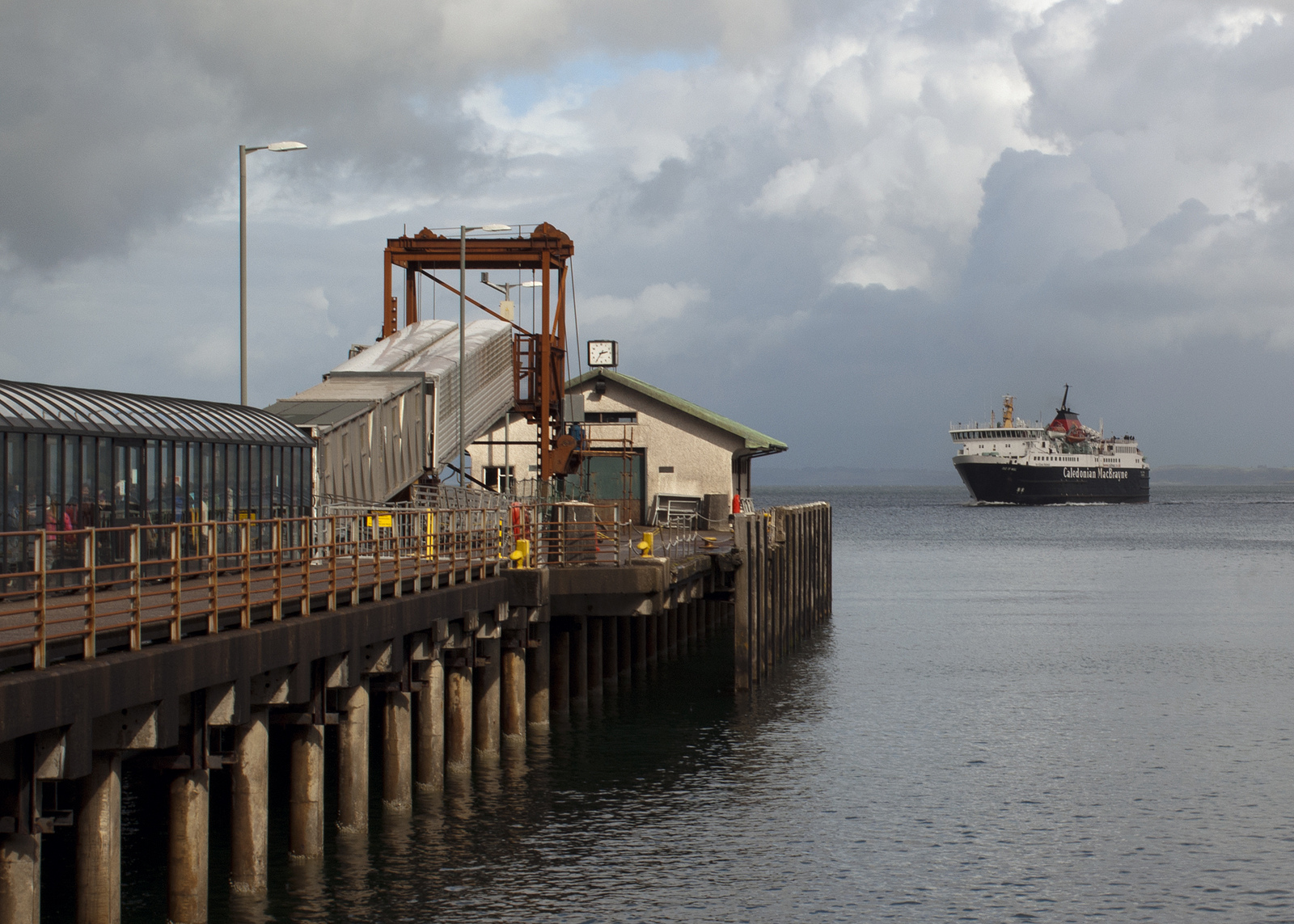
Meanwhile, I leave you with a photo I took in 1990 in Tarbert, Harris before the bridge to Scalpay had been built. I was quite chuffed that the Scalpay Community Land Steering Group chose it as one of the banner photographs for their website


POSTSCRIPT - Since I started writing this post (ages ago!), I learn from the excellent Arnish Lighthouse blog that the people of Scalpay have voted by an overwhelming majority (197 for, 8 against) to accept the gift of the island and also - though by a much slimmer majority (110 for, 96 against) - to become part of the neighbouring North Harris Trust community owned estate. That seems like an excellent middle course whereby the hassle of acquiring and owning the island can be minimised by drawing on the expertise in that regard already held by NHT and allowing a more uncluttered focus on delivering the priorities for Scalpay.

Sunday, October 28, 2012

Grass Point

Since 1964, the principal crossing to the island of Mull has been the Calmac car ferry from Oban to the pier specifically built for the purpose at Craignure. 

Craignure Pier by Alan Wright
Before 1964, Mull's principal connection with the mainland was MacBrayne's mail steamer which sailed from Oban once a day to Tobermory with intermediate calls at Craignure (a ferry call), Lochaline and Salen. Steamships revolutionised transport by making travel by sea a preferred option over travel by land (where there was no railway) but before they appeared on the north west coast of Scotland in the second quarter of the 19th century, the shortest sea crossing to an island was very much the order of the day just as it is today.

In the case of Mull, however, the pre-steamship crossing was even shorter than to Craignure: it ran to Grass Point at the mouth of Loch Don and so desperate were they to avoid the horrors of travel by sailing boat that the island of Kerrera was used as a stepping stone between Mull and Oban.

Note "Craiganune [sic] Kirk at top left where the present ferry terminus is: John Thomson's Atlas of Scotland 1832 from National Libraries of Scotland
The 1832 map above indicates that the Mull terminus used to be called Achnacraig (sometimes also spelt Auchnacraig) rather than Grass Point as it is now but, anyway, this is the pier the boats operated to: the quality of the masonry is a thing of beauty:-

Photo credit mikeh789
Photo credit Hector MacQueen
In the picture below from the opposite side of the bay, the pier is to the left of the cottage on the left:-

Photo credit mikeh789
The bigger house in the centre is still called The Old Ferry House (closer up picture of it here) and what you're looking at there is an early 19th century "ferry terminal". Apart from the pier, the vital infrastructure is the "ferry house". This was not just where the ferryman lived but also an inn for the accommodation of travellers who might have to wait for a night or more for a suitable conjunction of wind and tide to make the crossing. (There's a curiosity at Grass Point, though, in that some old maps - including the one above - mark what's now Auchnacraig Farm about a mile up the road as "Inn of Achnacraig". Whether that means the ferry house was not the inn or that the house pictured above combining both functions is more recent, I don't know.)

The opposite terminus of the ferry was at Barnabuck (also known as Barr-nam-boc) on the west coast of Kerrera. Here, the pier has collapsed into a pile of rubble although the ferry house survives as a farmhouse about half a mile inland.


I couldn't find any closer up a photo of the remains of the pier than the one below. At the back of the bay, you can see the retaining wall carrying the approach road out to the pier (the horizontal white line) but the pier itself has gone. If you click the photo to go large, you can see the houses at Grass Point on the opposite shore above the tree on the right:-

Picture credit Cthonus
[EDIT 6 February 2013 - the picture above was removed by Google after someone (I know not who) reported my use of it as being a breach of the US Digital Millenium Copyright Act! If it was the author of the photo, then I apologise for having breached your copyright. You can still see the photo via the link in the caption to the author's Flickr page. Meanwhile, below is a picture from Geograph which shows roughly the same scene but from a greater distance. The ruined pier and its approach road are in the red box. The houses at Grass Point are not visible - they're out of frame to the right.]

  © Copyright Eileen Henderson and
licensed for reuse under this Creative Commons Licence.

Of course, having landed on Kerrera, you still had to cross from that island to the mainland. As far as I know, that crossing was historically at the same point it's at today (not the ferry from Oban to the marina at Ardentraive, the one further down the Sound of Kerrera pictured below):-

Picture credit tingod
The only contemporary account of crossing from Grass Point to Kerrera I've been able to find is Johnson and Boswell in 1773. Boswell wrote:

"We bade adieu to Lochbuy [Lochbuie], and to our very kind conductor, Sir Allan M'Lean [22nd chief of the Macleans of Duart], on the shore of Mull, and then got into the ferry-boat, the bottom of which was strewed with branches of trees or bushes, upon which we sat. We had a good day and a fine passage, and in the evening landed at Oban where we found a tolerable inn."

To get a fuller flavour of the Mull ferry in centuries gone by, read the account of a passage across the comparable crossing from Orkney to the mainland in Charles Lesingham-Smith's "Excursions through the Highlands and Isles of Scotland in 1835 and 1836". You can read this on Google Books and the account of the passage starts on page 238.

"The ferry at Skarfskerry" - mainland terminus of the Orkney ferry in 1815 by William Daniell
As for the sort of vessel employed on these ferries, Lesingham-Smith crossed from Orkney in a 14.5 foot boat with two masts: apart from two crewmen, he was the only passenger. No doubt similar vessels were employed at Grass Point but this ferry was important for carrying not just passengers but also the cash crop of the islands in the earlier 19th century - cattle.

According to Jo Currie's "Mull - the Island and its People" (p.224), the Dukes of Argyll held the monopoly of transporting cattle from Mull to the mainland in the 18th century and members of a family called Gregorson were hereditary ferrymen at Grass Point. That probably just means several generations of Gregorsons leased Auchnacraig Farm from the Dukes and operated the ferry as an adjunct to it. I'm also just guessing as I type this that the name "Grass Point" is due to the fact there was grazing for the cattle before they embarked on the boats. And it's possibly no coincidence that, as the cattle trade would have involved contact with people speaking English (as opposed to Gaelic), hence the English name but I'm just guessing about that. Anyway, perhaps a boat similar to the one below (an early 20th century vessel employed at Kyle of Lochalsh for Skye) was part of the Grass Point fleet. Presumably it would have been towed across by a boat powered by oars:-


I don't know exactly when the Grass Point ferry ceased operating. The Ordnance Survey 25 inch scale map surveyed in 1871 shows it to be still in operation so perhaps it continued right up until the arrival of the railway at Oban in 1880 and the institution of MacBrayne's mail steamer service to Tobermory the following year.

OS 25 inch scale map, 1871
So to finish this off, I'll leave you with a picture of PS Carabinier, the first ever mail steamer from Oban to Tobermory and the ship that probably put Grass Point out of business:-

PS Carabinier - scan from Duckworth & Langmuir's "West Highland Steamers", 2nd ed. 1950. Photo credited to McIsaac & Riddle
EDIT - I've since discovered the Carabinier was not the first Mull mail steamer. The service was inaugurated in 1881 by a little steamer called the Cygnet but after just a few months, she was replaced by the Pioneer, the first of three vessels of that name in the MacBrayne's/Calmac fleet. The Pioneer operated the route until the Carabinier took over in 1893. The Pioneer (I) is seen at Corpach in the picture below:-


Wednesday, October 17, 2012

Out Skerries - crofting

This is a bit off the beaten track for the Kyles and Western Isles but I can't resist it because Out Skerries are for sale!


They're an archipelago about 10 miles (16km) east of Shetland. Covering about 1.5 square miles (4 sq km), the two biggest islands are linked by a bridge and between them support a population of 76. Boasting the UK's smallest secondary school (roll in 2010 - 3), this community of fisherman (including fish farm workers) is accessed by a 2.5 hour ferry journey from Lerwick though Shetland Island Council also runs a 20 minute flight three days a week (return fare £43 (£22 for pensioners), request stop at Whalsay).  Read about SIC's ferry and air services here.

Photo credit q3inq8
But if Skerries (as they're known locally) are too difficult for you to visit, don't worry because, thanks to top people's estate agents Knight Frank you can BUY them instead. No this isn't April 1st, "Out Skerries Estate" (as they've been branded for marketing purposes) is for sale at offers over £400,000! An entire archipelago of Scottish islands for less than half a million quid! How good is that?

Well, inevitably perhaps, not all that good. Apart from the fact the sale doesn't include the third biggest island, Grunay, (on the left in the photo above) or Bound Skerry (foreground - "Aw! Don't we get the lighthouse?"), it also doesn't include any sort of a house: all the houses (39 in all) and the infrastructure such as the pier, church, school, community hall etc. belong to the islanders or third parties such as the Council. (Interestingly, KF's brochure doesn't list the airstrip as excluded although I suspect that's an oversight otherwise they'd be painting a glowing picture of investment opportunities arising from the valuable landing slot rights at OUK!)   


The only buildings a purchaser would take ownership of, the brochure notes, are "two, now derelict, buildings formally [sic] used as a coastguard lookout and signal post." The absence of estate agent hyperbole talking up the potential for conversion into an insular dez rez speaks volumes.

But you're buying 600 acres (250ha) of choice of site for a new house, aren't you? Again, not quite and the reason for that is also mentioned in KF's brochure - the whole "estate" (except the offlying islets) is subject to crofting tenure. Crofting is something I've been meaning to write about for a while: I've never known quite where to start with it but Out Skerries provides a catalyst.  

Crofting

Photo credit Donald Mackinnon
Some people think they're a type of house (above) but crofts are, in fact, a species of small-holding unique to the north and west of Scotland, particularly the islands. The typical croft is about 5 to 10 acres (2-4ha) and located in a "township" of, typically, 10 to 20 crofts. As well as their individual holdings where their crops were grown and animals wintered (known as "in-bye"), the crofters in a township share a much larger surrounding area called the "common grazing". This can be hundreds or even thousands of acres.

Skerries is a crofting township. The KF brochure informs us there are 15 crofts with about (I'm guessing) 75 acres (30ha) of in-bye between them. The rest of the islands is all crofters' common grazing.

The township and in-bye on Housay
In theory, crofters are tenants of a landlord who owns the land (in-bye and common grazing) and to whom a rent is paid under a lease running from year to year. Crofting rents are nominal - KF tell us the 15 crofters of Skerries pay just £167.18 in total between them. Croft rents are low not just because the holdings are small but also because, on most crofts, the landlord didn't provide the house and other infrastructure as is the case with a normal let farm.

The township and in-bye on Housay in the 1950s - one of a number of excellent pictures in the Shetland Museum archive
But anyone thinking of buying "Out Skerries Estate" with a view to throwing the crofters out and replacing them with something willing to pay a higher rent can think again because, ever since 1886 (in the aftermath of the "Highland Clearances"), crofters have had security of tenure. That means they can't be evicted so long as they keep to the statutory conditions of crofting. And even if a crofter did breach the conditions, it's not worth the landlord's while evicting him because he would be obliged to pay the departing crofter compensation for the value of the house on the croft and then immediately re-let it to a new crofter and so the whole process starts over again.

Crofters also have the right to sell their tenancies and bequeath them on death so, for all these reasons, crofting tenancies tend to continue indefinitely. It's misleading to think of them in terms of "tenancy" and "lease" as these words generally connote a temporary relationship. "Tenure" is a more appropriate word reflected in the fact that, since 1976, crofters have had the right to buy the freehold of the in-bye of their crofts (not the common grazing) at a price equal to 15 times the annual rent. In practice, crofters relatively seldom (compared with, for e.g., council house tenants) buy their entire crofts but most have bought their houses. From what can be gathered from the KF brochure, this appears to be the pattern on Skerries - most if not all of the croft houses have been bought but none of the actual crofts.

Out Skerries in 1877 - OS 6 inch map
As I said about the sale of Taransay, there's no such thing in Scotland as a "private island" (a la Mustique or Branson's Necker Island etc. in the Caribbean). Despite what it says in the brochure about viewing being strictly by appointment through Knight Frank, anybody is legally entitled to go to Skerries on the public ferry or plane at any time. So long as you comply with the Scottish Outdoor Access Code (which is basically "be aware of and respect the livelihoods and privacy of the people who live there"), you don't have to own Skerries to enjoy the nature the estate agents wax lyrical about (even if they can't spell it):-

"In early summer the islands are covered in wild flowers; in particular Sea Pinks, but it [sic] is most well know [sic] for its bird life and as a breeding ground for Terus [sic], Kittiewakes [sic], Shags, Oyster Catchers, Eider Duck, Fulwars [sic] and Gulls."

The harbour at Bruray by Ronnie Leask

So what are you actually getting for your £400,000 on Skerries apart from that £167.18 a year of rent from the crofters?

Gold, silver, coal, oil and gas are all the property of the Crown but if there are any other valuable mineral deposits on or under the islands, these would belong to the landlord. Another perquisite of the crofting landlord is the shooting and game fishing rights: some common grazings are noted deer stalking forests and/or have salmon rivers running through them although there's scant potential for huntin', fishin' or shootin' on Skerries.

Perhaps the most significant right a crofting landlord has is to "resume" land. That means regaining unencumbered vacant possession from the crofters. However, resumption requires permission from the Scottish Land Court and it will only ever consent to release land for something planning permission has been obtained for and which doesn't threaten the continuation of crofting in the vicinity. And crucially, resumption is also subject to payment to the crofters of half of the market value of the land resumed. Yes, that's right! - you've already shelled out 400 big ones and you still have to pay more for the land to build your house, diving & birdwatching lodge, drug rehabilitation centre, crystal growing factory, etc. whatever.

Skerries at OS 1:25,000 scale from Streetmap
In many ways, the role of a crofting landlord can be a negative one in that he can block development of the common grazings. There's no reverse process whereby the crofters can "resume" from the landlord - they couldn't force him to accept, say, a community wind turbine on the common grazings. For that reason, legislation in 2003 gave crofting community bodies the right to buy entire townships complete with the common grazings. KF's website alludes to this on Skerries when it says "the crofting community have been offered the opportunity to register their interest in acquiring the property but have formally declined from doing so." But the legislation doesn't include provision for "registration" or "declinature". So a prospective purchaser should note that the tenantry could buy it off him at any time if they didn't care for the cut of his jib. And Lottery funding is available to pay for it.

Photo credit Markus Schroedr
Wonderful opportunities for fishing and sailing it says in Knight Frank's brochure. My advice if you've six figures burning a hole in your pocket would be buy a boat rather than the destination.

Thursday, October 11, 2012

Mills Rocks

In the 1970s, I recall sailing out from Tobermory north west for the Outer Hebrides into a westerly. The destination was ideally Castlebay on Barra but Lochboisdale on South Uist or even Lochmaddy on North Uist were possibilities if we couldn't point Castlebay. Several hours into a not entirely pleasant experience, I remember calling out in a mixture of triumph and relief "I can see the lighthouse on Oigh-sgeir!" (Wrongly pronouncing it "Oy Skeer" - it's actually "Hesker") And my father replied "Aye, but it's not Oigh-sgeir we need to worry about, it's the Mills Rocks."

These are an unmarked reef about 2 miles south west of the lighthouse - potentially right in the path of a yacht bound for Castlebay inevitably being deflected northwards by the wind, tide and lee-way in the days before GPS.

I can't remember now whether we made Castlebay or ended up in Lochboisdale - the Acarseid Mor (Gaelic for "big anchorage") on Eriskay in between the two is another possibility. But the name of "the Mills Rocks" has stuck in my mind ever since.


Not least because of the overtly English name of this reef compared with others I recall from my sailing days in the 70s and 80s such as Bo Faskadale, Bo Vich Chuan, Sgeir Inoe, Dhubh Hirteach et al.

There is another English named rock I can think of - the Lady Rock at the southern entrance to the Sound of Mull. It's allegedly so called because some MacLean chief of old abandoned his faithless Campbell wife (might be the other way round) there to be drowned by the incoming tide. But I've always assumed this to be apocryphal because, if true, why is the name of the rock English rather than Gaelic as reflecting the times?

But there's no doubting the provenance of the name of the Mills Rocks as I chanced upon while browsing maps at National Libraries of Scotland website the other day: Thomas Kitchin's A new and complete map of Scotland and islands thereto belonging of 1773 tells us exactly why the Mills Rocks are so called:-

Another old map on the NLS website notes the rocks were discovered in 1731 rather than 1733 but I can't remember which map that was so can't link to it - if you've got the time to spare, you could probably while away a pleasant few hours looking for it.

Meanwhile, back in the 20th century, I recall in 1988 being on a Calmac ferry (the MV Claymore (1978)) en route from Lochboisdale to Oban and she passed to the north of Oigh-sgeir which is a slight deviation north of the direct route. I wonder if that was due to a desire to be sure of avoiding Mills Rocks to the south of Oigh-sgeir? Do today's ferries with the benefit of GPS still make a similar detour? (Can they pronounce it correctly?)


Actually, now that I think about this, there are other English named rocks. There's a Jemima Rock on the chart above and I can think of Eugenie Rock and Comet Rock between Skye and Harris. All doubtless have tales to tell.